Mature Content: Kenny Rogers serenades Carbondale
Ron Kokish – May 15, 2024
Mature Content is a monthly feature from Age-Friendly Carbondale
n May of 1985, my job was troubleshooting the most difficult cases for my county’s child protection program, which I’d helped found a few years earlier. A respected expert in my field, I lunched with attorneys, probation officers, and judges. Both of my teenage children were about to enter college and I owned a marijuana farm in Oregon, just across the California state line.
Although I liked my work, I now hated the agency I worked for. But I was well paid and, with looming college expenses, I felt trapped. I knew two social workers who were earning more with their weekend marijuana growing than they did at work, so why not? My buddy Mike and I bought 75 acres near Cave Junction and started “developing” it. We figured we’d do it long enough to put those college expenses aside, at which time we’d be freer to leave our depressing jobs.
To this day, I don’t know what changed for me. I went to bed on a Monday evening feeling optimistic. At 2am Tuesday, I woke up to visions of being arrested at work, led past my peers in handcuffs, my reputation, license, and career gone forever, along with my house and, probably, Niki who had never really liked the idea.
I called Mike to share my sudden awakening. He didn’t see it that way but, with some urging from his wife, he agreed to consult Robert Cogan, a good friend and respected dope lawyer. Bob listened respectfully while we detailed our plan and its progress. (By now, we had 200 beautiful young plants in the ground). When we finished, Bob said, “I want you to drive up there immediately, and pull and burn every plant.”
Then he told us the mistakes we’d made. We’d put title to the land in our own names. We’d bought our topsoil, hoses, pumps (one of which had already been stolen), and deer fencing less than 30 miles away. We were strangers in a town where we stood out like sore thumbs. Local authorities and their federal friends, Bob assured us, were just waiting for our plants to mature. Because we had crossed state lines, we would be taken straight to San Francisco to face federal charges. He finished with, “…and there will be nothing I can do for you.”
We rushed off to buy kerosene and at 2am on Wednesday, feeling sad, stupid, and relieved, I drove home while listening to Kenny Rogers on my 8-track. “You gotta know when to hold’em, know when to fold’em, … etc.” Disaster averted!
I had another, similar awakening two weeks ago while I was working on Age-Friendly Carbondale’s (AFC) Highway 133 Report, but this time the fear isn’t for myself and my family. It’s for the town I’ve come to love, because 133 is changing Carbondale as dramatically as that farm could have damaged my life.
Half a thousand respondents told us (AFC) that they want to walk and bike more, but they’re afraid of the Highway 133 corridor. They’re afraid to have their children walk or bike along it unaccompanied and they’re terrified for them to cross. They said that traffic moves too fast, that there aren’t enough marked crossings and that even the existing crossings don’t feel safe. Our most vulnerable population, people who rely on wheelchairs for their mobility, told us they “jaywalk” at Nieslanik to avoid traveling the extra distance to marked crossings that are inadequate for them anyway.
We wanted growth, and with good reason. We knew there’d be downsides, but rather than making the hard decisions needed to minimize those, we approved one development after another without installing the requisite infrastructure.
We glossed over obvious problems with comforting buzzwords like “smart growth” and “preserving small-town character.” Several reports and some residents told us what we needed to plan for but, like Mike and me, we were too intent on what we wanted to let that get in our way, and like our wives, the nay-sayers didn’t shout and pout and cry loud enough and long enough to break through.
So, here we are, afraid to let our children near the highway that should have been, and still can be, a boulevard. There are planned improvements in the works, but they are slow in coming and they appear insufficient to restore our rapidly-fading small-town character.
So, once again, I woke up terrified. But this time, it will take more than a night’s work and 20 gallons of kerosene to undo the harm. In keeping with this urgency, for the next eight to 10 weeks The Sopris Sun will publish weekly specifics about each problem our respondents pointed to, and our recommendations for addressing those problems. Look for these segments beginning next week. Until then, you can read our complete report and watch the video recording of our presentation to the Bicycle-Pedestrian Commission at www.bit.ly/133-presentation

133: Dangerous as Designed – Age-Friendly Carbondale
May 22, 2024 – Excessive Speed
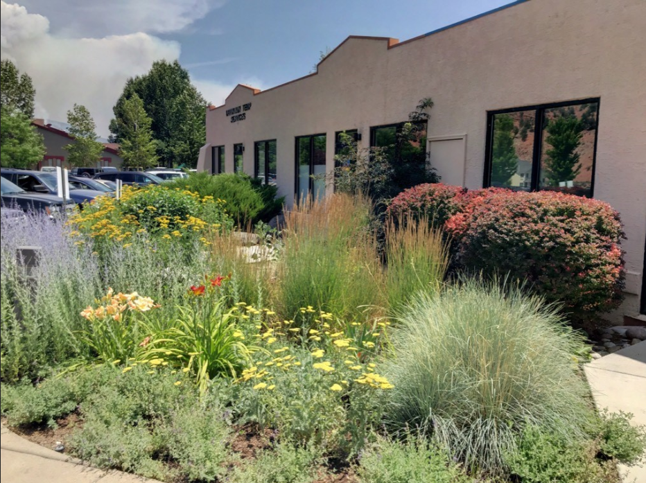
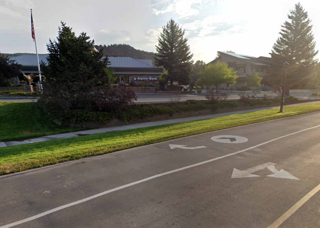
Imagine driving into Carbondale from Highway 82. Just past the Cowen intersection a large, attractive sign arching overhead reads,” Welcome to Carbondale’s Bonedale Boulevard. Speed Limit – 25 mph.” Narrowing lanes , central planters, shrubbery along the curbs, pedestrian refuge islands, roundabouts, and signalized, raised crosswalks every 600 feet (2 city blocks) make it unlikely that you will want to exceed that limit.
For more than a year, Age-Friendly Carbondale (AFC) has been studying what residents and frequent visitors think Highway 133 is like and what we would like it to be. The study is now complete and the paragraph you just read describes what we think most people want. There are many obstacles to achieving it, but one obstacle affects all the rest and has to be overcome before other significant improvements can be made. That obstacle is vehicular speed.
Respondents repeatedly cited excessive vehicular speed as contributing to accidents, near accidents, and most of all, to fear of being in an accident as a pedestrian or cyclist. They said they would increase their walking by 24% and cycling by 72% if they weren’t so afraid.
The speed limit from Highway 82 to Meadowood Lane is 35 mph, including the “School Zone” from Keator Road to the Snowmass Drive intersection and road conditions make motorists comfortable driving at that speed and faster. The school zone speed limit does not change during school hours. Lack of crosswalks in a school zone does NOT prevent people from crossing. In fact, this school zone is one of the areas where adults, children, and even wheelchair users commonly jaywalk.
Research supports people’s fear of excessive speeds. When a vehicle travelling at 20 MPH contacts a pedestrian the fatality likelihood is 8%. At 30 MPH it’s 20%, and at 40 MPH it’s 46%. Locally, danger is exacerbated by increased traffic volume from recent developments, increased volume of vulnerable users from the same developments, a growing number of distracted drivers, and increasing environmental distractions. To reduce the danger, we need to do two things: Lower the speed limit and redesign the street to make motorists feel unsafe when they speed.
Existing Colorado law allows us to move in the direction of lower speeds on 133 inside town limits. This is the essential first step for transforming 133 from a fast-moving vehicular corridor to a pleasant boulevard that accommodates motorized traffic without prioritizing it over pedestrians, cyclists, and even more vulnerable users. But it is only a first step, and it’s the easy part, because most of us don’t drive at the posted limit. We drive as fast as it feels safe to drive. That means major redesign work from Highway 82 to RVR. We’ll talk about the specifics of that in the coming weeks.
133: Dangerous as Designed – Age-Friendly Carbondale
May 29, 2024 – Jaywalking, Part 1
What do run down batteries, shoulder pain, a Dollar Store, and peaches have in common? If you read the title, you probably know. It’s jaywalking across Highway 133 at Nieslanik Avenue. Niki likes fresh peaches. For most of the summer and fall, the best peaches in Carbondale are sold by a street vendor near the Co-op. After shopping at City Market, Niki’s way home takes her to Village Road. But once she crosses 133, she’s not about to walk the extra mile to the co-op and back just for a peach, not when she can jaywalk directly to Peach Heaven at Nieslanik Avenue.
Adam depends on a battery powered wheelchair for his mobility. He shops at City Market, The Co-op, The Dollar Store, and also likes the occasional peach. Aside from the time it takes him to travel the ½ mile from Nieslanik to the roundabout, he worries about his battery running down before he can get home. So, he Jaywalks at Nieslanik Avenue. Tom, another wheelchair user pushes his chair manually. After years of doing this, he is limited by chronic upper body stress injuries and ½ a mile adds to that problem. So, like Niki and Adam, Tom Jaywalks at Nieslanik Ave.
For true walkability, signalized crossings every 300 feet is ideal and 600 is the maximum suggested distance. (International Road Assessment Programme Toolkit, Global Designing Cities Initiative) This guideline is consistent with what U.S. Dept. of Transportation suggests. The distance from Village Road to Main Street exceeds the maximum suggested distance by a factor of more than six. Nearly everyone who lives in or near Carbondale shops at Roaring Fork Marketplace. Development there has brought new prosperity to Carbondale and has the potential to transform Route 133 from a through-road adorned by deteriorating strip-malls into a vibrant street filled with retail shops, restaurants, health and wellness centers and modern residences. What’s missing is “walkability,” an essential ingredient of the “small-town character” embedded in our Comprehensive Plan since 2013.
133: Dangerous as Designed – Age-Friendly Carbondale
June 5th, 2024 – Jaywalking, Part 2
In last week’s installment, we began a discussion of jaywalking. If pedestrians need to cross a street and the nearest safe crossing is three minutes away, most people will cross where it’s convenient. No amount of education or law enforcement will change this. Last week, we discussed the popular “jaywalk” crossing at Nieslanik. This week we’ll tackle Dolores Way, and next week we’ll finish the jaywalking part of this series with a discussion of Weant Boulevard, Lewies Lane and Keator Road.
Bracketed by a bank and a large bike and ski shop where it meets 133, Dolores Way is almost a quarter mile from the nearest signalized intersection. It’s also the only vehicle entrance to unincorporated Satank, which houses numerous retail and manufacturing businesses (including Double Diamond Moving & Storage), private homes, a new apartment complex and two schools. Directly across 133 is La Fontana Plaza with several shops, two restaurants and Rio Grande Trail access with multiple growing retail businesses to the south. Like Nieslanik, Dolores Way is an open invitation to jaywalking.
Many people have advocated for a safe crossing at Dolores for over a decade. Tamar Mattorano, a Satank resident since 1963, has documented every call, petition and meeting with elected and appointed officials. She has repeatedly voiced concerns about the dangers of near misses between vehicles and pedestrians. “There is no break in south or northbound traffic. Cars turning south from Dolores onto 133 often speed through the intersection to beat the next wave of traffic,” she stated.
It’s not surprising that Tamar is just one of many people who told us they witnessed cyclists and pedestrians jaywalking and navigating through traffic gaps to cross the street. Walking to a signalized intersection to get from Satank to La Fontana Plaza and the increasing number of businesses to the south adds nearly half a mile to a pedestrian’s trip.
This dangerous “jaywalk” crossing is highlighted in the 2013 Access Control Plan, the 2022 Comprehensive Plan and Safe Routes to Schools. The issue has involved various agencies, including RFTA, CDOT, the Garfield County Board of County Commissioners (BOCC) and Carbondale’s Board of Trustees. In 2013, BOCC Chair John Martin said, “There is a safety issue on Dolores Way, and it’s [Carbondale Community] School. That takes precedence over private drive access for RFTA. We need to make sure our priorities are in place.”
RFTA had different priorities and access to the bus complex that would have allowed traffic from Dolores to meet 133 at the Village Road light. CDOT since refused to install a traffic light, citing Dolores’ proximity to the Village Road light and its potential to impede traffic on 133. Also in 2013, officials tentatively agreed to address the problem with a roundabout at La Fontana Plaza. This solution was, however, not incorporated in that year’s Access Control Plan. Here we are, 11 years later: more people, more traffic, same problem
133: Dangerous as Designed – Age-Friendly Carbondale
June 12th, 2024 – Jaywalking, Part 3

According to Safe Kids Worldwide, half of all school zones in the U.S. have speed limits above 20 miles per hour — 30% lack marked crosswalks. Couple these ingredients with a considerable number of vehicles, pedestrians and cyclists near schools during student drop-off and pick-up times, and you have a recipe for disaster. We have it in spades at Ross Montessori School. It abuts a state highway. The nearest signalized crosswalk is over one-third of a mile away. It’s across the highway from residences, the library, downtown, the Rec Center, Third Street Center and three public schools — all places where children go after the school day ends. The speed limit is an almost unbelievable 35 mph, even during arrival and departure times.
In April 2019, outdoor educator and former chair of the Bike Pedestrian and Trails Commission Darryl Fuller, expressed his concerns in a letter to CDOT that he shared with Garfield County commissioners and Carbondale trustees.
“On the subject of safe mobility for young people, is perhaps an even greater concern regarding Safe Routes to Schools at 133 and Weant Boulevard across from Ross Montessori school. To my mind, this is a tragedy waiting to happen and completely irresponsible. Not only do we see students darting across the road at the school (why wouldn’t they? Expecting anyone, let alone every elementary-aged child at the school to walk out of their way to cross at signalized crosswalks at Snowmass Drive or Hendrick Drive is not realistic). Additionally, the school zone speed limit here is 35 mph! That’s the same speed limit at both adjacent segments of 133. Without the addition of a signalized crossing at Weant and 133, and/or a decreased speed limit, I fear it is only a matter of time before we have an otherwise avoidable accident.”
A person living on the west-side told us, “People know that Jaywalking is dangerous. A sign may read, ‘no crossing,’ but it is too far from the lights, so people just cross without crosswalks.” A cyclist remarked, “I look for breaks in the traffic to cross from Keator Road to Seventh Street because it is the quickest and most convenient access to downtown.” A concerned parent said, “I witness kids running across 133 from Montessori because it’s too far to cross at Snowmass or Sopris to get to the Third Street Center.”
We know that when the nearest crossing is over 300 to 600 feet away, people will Jaywalk (www.tinyurl.com/JayWalk133). We knew it eight years ago. Why did we build a K-8 school alongside a fast-moving highway with after-school attractions directly across from it and put the nearest signalized crossing 1,700 feet away? We’ve been lucky for eight years. Will we rectify this mistake before some child’s luck runs out?
133: Dangerous as Designed – Age-Friendly Carbondale
June 19th, 2024 – Cowen Drive
For the past three weeks we’ve examined places where non-motorized users have created dangerous “social trails” across Highway 133. This week, we’ll begin examining signalized crossings, starting with Cowen Drive and working our way south.
Cowen is a significant intersection. TheCowen Center gas station with a market, animal hospital, offices, shops and restaurants in and near it, two motels (and alot zoned for a third motel) constitute the north entrance to commercial Carbondale. A mobile home park on the west side feeds motorized and non-motorized traffic into and across 133.
The crosswalk on the south side of Cowen has a useractivated signal, but crossing time is too short for mobility-limited users. Thankfully, a refuge island slated for installation in 2024 will remediate that issue. The signal, like all user-operated crossing signals in Carbondale, lacks but needs visible and auditory indicators to reassure pedestrians that it is flashing and inform them when it stops.
Cowen Drive is a designated priority corridor leading to the town core via Eighth Street, meaning we encourage people to walk that way. Of great concern is 80 feet of missing sidewalk on Cowen’s south side, forcing cyclists and pedestrians coming to and from the crosswalk into the street precisely where cars and trucks make right turns from 133 onto Cowen without having to stop. Completing the sidewalk would eliminate this very dangerous situation.
The path on 133’s east side provides access for cyclists and pedestrians to and from the popular Red Hill Recreation Area. At Cowen, they cross four lanes of traffic, with northbound cars making right turns without stopping and southbound cars making left turns. A signalized crossing on Cowen Drive would eliminate the danger.
Northbound 133 changes from a single to a two-lane highway at the Village Road light, enticing drivers heading for Highway 133 to increase their speed along that stretch of road. Many are looking to the distant Highway 82 traffic signal; when it is green, increased speeds become even more likely. With their focus on the more distant objective, the yellow crosswalk signal could easily be missed or ignored. Lowering the 133 speed limit and installing traffic calming features would significantly reduce this danger. With cars being permitted to make right and left turns from Cowen and from both directions on 133, the non-signaled intersection can be confusing. It has a history of producing automobile accidents that could easily ensnare pedestrians. Lowering vehicle speeds on 133 would reduce these risks as well.
To our knowledge, there have been no fatalities or major injuries at the Cowen/133 intersection yet, but much needs to be done to maximize pedestrian and cyclist safety there.
133: Dangerous as Designed – Age-Friendly Carbondale – June 26th, 2024 – Village Road
This week’s focus on State Route 133 in Carbondale highlights the heavily trafficked and signalized intersection at Village Road. There are side paths on both the east and west sides of Highway 133, with a crosswalk located on the south side. However, the sidewalk along Village Road is situated on the north side. Residents living on the south side often walk in the road, facing oncoming traffic making sharp right turns onto Village Road from the highway, or they walk on the grass to reach the crosswalk.
Carbondale’s Park & Ride is located on the southwest side of the intersection. During peak hours, buses arrive and depart every few minutes from both the north and south, making right and left turns. Automobile traffic from all four directions turn left, right or proceed straight ahead. There is significant bicycle and pedestrian traffic associated with the buses, the Park & Ride and the Rio Grande Trail, which intersects the Park & Ride before crossing Highway 133.
The recent extension of the west side bike-pedestrian trail to Cowen Drive has no crosswalk or signal. Thus, Village Road is no longer a fully signalized four-way intersection. This set of conditions creates many opportunities for conflict between motorized vehicles, bicycles, and pedestrians and makes Village Road one of the busiest and sometimes most confusing intersections in Carbondale.
Respondents to our 2023 survey offered many anecdotes about their experiences at this intersection. For example, “I was crossing east to west. I waited for a green light. I looked both ways. A driver in a pickup truck on his phone tried to beat a yellow light and speeded up on red.” And, “A bus driver driving the circulator barely missed hitting me when he was making a right onto 133 and I was already in the crosswalk going west-east with a green light.”
Pedestrians and cyclist safety could be improved by:
- A raised north/south crosswalk on Village Road to discourage cars heading west on Village Road from queuing up in a way that impedes pedestrians.
- Advanced stop-lines or bike boxes for cyclists approaching from Village Road.
- Brightly marking crosswalks to create a distinctive square, as pictured on page 45 of our complete report (www.bit.ly/133-Report).
- Extending east/west crossing times for pedestrians, including a “head start” for pedestrians before automobile signals go green.
- Addition of two marked crosswalks: one on the west side of 133, another on the north side of Village Road.
- Traffic calming infrastructure to slow northbound cars on 133 turning right onto Village Road.
- Warning signs/lights to slow motorized traffic approaching along 133.
- Separate pedestrian and cyclist lanes where the Rio Grande Trail crosses 133.
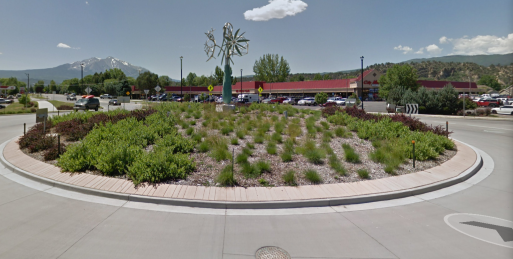
133: Dangerous as Designed – Age-Friendly Carbondale – July 3rd, 2024 – The Roundabout
This week, moving south along State Highway 133, we’ll examine the Main Street roundabout. Roundabouts are increasingly popular with the public and traffic engineers. They cost about as much to install as intersections with traffic lights, move traffic more efficiently and are touted by the U.S. Department of Transportation as reducing fatality and serious injury rates by as much as 82%. What’s not to like? We were surprised that on our comment cards, the roundabout was mentioned as problematic more often than any other intersection. Residents made comments like:
“Car coming downvalley did not slow down, did not see me in crosswalk and narrowly missed me. Now I am afraid to walk across at the roundabout.”
“Pickup truck did not stop. I was halfway across. Double-lane entrance creates frequent problems. Second car’s view of crosswalk and my view of that car obstructed by first car.”
Such comments appear to identify irresponsible drivers as the primary danger, but a basic tenet of modern road design is that vulnerable user safety cannot depend on self-managed driver behaviors. Driver behavior must be redundantly designed into the road itself.
Upon investigation, we found that conclusions about roundabout safety benefits are drawn mostly from studies of motorized vehicle accidents. Federal and state guidelines favoring roundabouts point to lower vehicle speeds, fewer pedestrian/bicycle–motorized vehicle conflict points and safer pedestrian starting locations to support assertions that roundabouts are safer for pedestrians and cyclists. This may be correct, but we were unable to find convincing empirical research testing that assertion. In fact, some experts disagree with it.
Moreover, much of the data we do have refers to single-lane roundabouts. Ours has two lanes. In their information guide on roundabouts, the Federal Highway Administration says, “Pedestrians crossing double-lane roundabouts are exposed for a longer time, and to faster vehicles. They can also be obscured from, or not see, approaching vehicles in adjacent lanes if vehicles in the nearest lane yield to them. Children, wheelchair users and visually-impaired pedestrians face particular risks. Bicycles are also more exposed to severe conflicts when choosing to circulate with motor vehicles.” Limited research indicates that two-lane roundabouts reduce serious accidents by as little as 9% and may even increase them.
CDOT operations engineer Bill Crawford confirmed that two lanes are more dangerous than one. Nonetheless, he said that CDOT believes roundabout safety at Main Street is acceptable, and that two lanes are needed to handle existing and anticipated volume. CDOT would oppose redesigning it to one lane.
In closing, we can only say that our roundabout is there, it’s staying, it probably ought to be made safer than it is and we have some ideas around doing that. Stay tuned and we’ll try to keep you in the loop, so to speak.
133: Dangerous as Designed – Age-Friendly Carbondale – July 10th, 2024 – Hendrik & Sopris
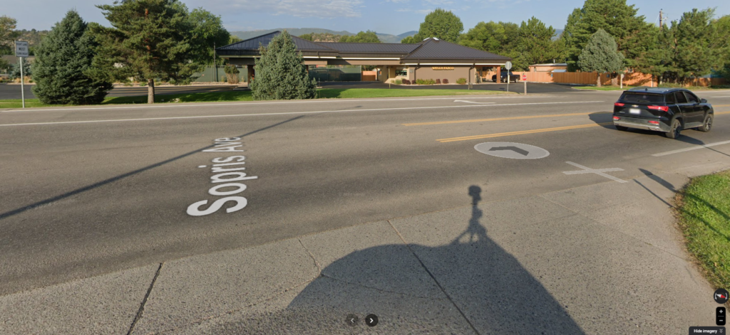
The next intersection in the 133, Dangerous as Designed series is Hendrick Drive and Sopris Avenue. This is an oddly configured intersection because Hendrick and Sopris are not aligned, adding to its complexity and making it more difficult to negotiate safely.
Several factors make this intersection unsafe. The first is speed. Leaving the roundabout southbound, 133 follows a straight path “encouraging” drivers to speed up. At Sopris, 133 becomes three lanes because of the dedicated right turn lane for Wells Fargo Bank and Hendrick giving drivers further encouragement to speed. This happens just as drivers are about to reach the 133 crosswalk.
The second is the location of entry and exit points. Hendrick and Sopris are offset, making it difficult for drivers to see one another. Both streets have drivers turning right and left turn onto 133. Drivers are exiting 133 as well, turning onto both Hendrick and Sopris. If keeping track of who is going where is not difficult enough, bike paths on both sides of 133, the user-activated crosswalk signal and the shopping plaza entrance across from Hendrick add to the challenge.
The third is road width. Hendrick and 133 are three lanes wide and Sopris is wide enough for drivers to use it that way. This width increases the traffic exposure time of users and the complexity of the view of traffic movement.
Age-Friendly Carbondale (AFC) received many complaints about this intersection: cars travel too fast, cars don’t stop when the crosswalk lights are flashing, drivers are distracted, reports of near misses and more. To address these issues, AFC recommends:
1) Decreasing vehicle speed by adding traffic-calming elements to 133. This could include the elimination of the right turn lane on 133 at Hendrick (moving the curb accordingly), converting to a raised 133 crosswalk and adding speed signage in the median.
2) Upgrading the current crosswalk signal to a high-intensity signal that places the flashing lights overhead, in drivers’ line of sight, and uses a light sequence similar to regular traffic signals.
3) Install a pedestrian refuge island in the 133-crosswalk to provide a safe waiting spot for users crossing one direction of traffic at a time. It would also be a traffic-calming element.
4) Improve lighting for increased safety after dark.
This intersection is widely used. Children and adults (including seniors from Crystal Meadows) cross 133 to access Main Street’s shops and restaurants, the library, Stepping Stones, Sopris Park, the pool, the Rec Center, Hendrick Park’s soccer field and more, as well as to visit friends and family. Making this intersection safer is about reducing the potential for accidents, but it’s also about preserving, and enhancing Carbondale’s small-town character.
133: Dangerous as Designed – Age-Friendly Carbondale
July 17th, 2024 – The Paved Futon
Lorem ipsum dolor sit amet, consectetur adipiscing elit. Ut elit tellus, luctus nec ullamcorper mattis, pulvinar dapibus leo.
We conclude our review of crossings along 133 with Snowmass and Meadowood Drive, the only two where survey respondents did not report perceiving unsafe conditions. That said, let’s take this week to examine the nature of 133.
Roads move people from point A to point B quickly, efficiently and, usually, safely. In the song “Ramblin’ Man,” the Allman Brothers Band sings: “I’m on my way to New Orleans this mornin’, leaving out of Nashville, Tennessee.” Dorothy skips down the Yellow Brick Road to her various destinations around Oz. Willie Nelson wants to get “on the road again” to places he has never been. Dorothy, Willie and the Allmans don’t stop to shop, find a good restaurant or visit the farmers market. They are traveling from one place to the next. They need a “road.”
The Beatles sang: “In Penny Lane, there is a barber showing photographs of every head he’s had the pleasure to know, all the people that come and go, stop and say ‘hello.’” Penny Lane is a “street.” Rather than getting you from one place to another place, streets are places. They provide housing, access to services and recreation. Streets are the lifeblood of a community. They create wealth, slow traffic and have infrastructure designed to strengthen the fabric of a community. People live their lives on streets — children, caregivers with strollers and walking dogs, pedestrians, cyclists, older adults and people with mobility challenges.
Highway 133 was established in the 1920s, as a vehicle thoroughfare from Bardine (near Paonia) to Carbondale, according to Wikipedia. Over the next few decades, the road underwent many changes. By 1954, a large segment had been removed, and only a four-mile section near Carbondale remained. By 1978, the route was expanded and completely paved. As Carbondale grew, it expanded along both sides of 133. Essential services like housing, restaurants, shopping, medical services and recreation have changed the thoroughfare’s nature and utility. Rather than skirting Carbondale, 133 now divides it, with too few safe ways for vulnerable users on either side to access goods and services on the other.
Highway 133 no longer moves motorized traffic efficiently enough to be a road, but it’s not safe or efficient for vulnerable users going about their local business either. We’re trying to make 133 serve two conflicting functions, so naturally, it serves neither function well. We call this kind of hybrid a “stroad.” Stroads are the futons of our transportation system because a futon tries to be both a bed and a couch and is not good at either. Highway 133 is our paved futon. Next week, we’ll conclude this series with recommendations for redesigning it.
133: Dangerous as Designed – Age-Friendly Carbondale
July 24th, 2024 – The Fixes

The first eight columns in this series reported the results of Age-Friendly Carbondale’s year of work on State Highway 133 inside town limits. We reviewed many previous studies and reports, spent four months listening to residents and eight months analyzing over 4,000 responses from more than 500 individuals. Last week’s column, the ninth in this series, concluded that inside Carbondale, 133 has become a “stroad” — a thoroughfare that is expected to simultaneously be a “road,” efficiently and safely getting people from one place to another, and a “street,” a place where people reside, access goods and services, recreate and accumulate wealth. A stroad, while serving both functions, serves neither well. Our stroad, we wrote, should be redesigned and rebuilt as a street.
Three synergistic features lead to the “stroad” designation. There are too few pedestrian crossings, many existing crossings are not as safe as they should be and, most importantly, motorized traffic moves too fast.
Here, concluding our series and based on our analyses in the first nine parts, are Age-Friendly Carbondale’s recommendations for recreating State Highway 133 inside town boundaries. These recommendations align with the U.S. Department of Transportation’s “National Roadway Safety Strategy” and are cited in Colorado’s Vulnerable Users Safety Assessment.
Highest Priority
- Rename the thoroughfare “Carbondale Boulevard.” Install billboards or banners spanning the boulevard, welcoming people to Carbondale Boulevard at the north and south entrances.
- Add signalized, raised crosswalks with refuge islands at City Market, Dolores Way, Ross Montessori. Raise existing crosswalks. Upgrade the existing crosswalk at Hendrick Drive. Make all crosswalks high intensity, i.e. flashing lights placed overhead for better visibility, flashing red rather than yellow, and an auditory signal for reassuring pedestrians in the crosswalk.
- Construct a single-lane roundabout with pedestrian crossing at Industry Way. (planned, date uncertain)
- Calm traffic with sidewalk bulb-outs near all pedestrian crossings. Place additional landscaping and artwork between the bulb-outs.
- Add a refuge island at Cowen Drive. (scheduled for 2024)
- Install flashing red right-turn arrows in right-turn lanes at Hendrick (southbound) and Village Road (northbound).
Second Priority
- Reconfigure the Main Street roundabout to single lane.
- Add extensive wayfinding, indicating that drivers are inside a thriving town.
- Improve street lighting at pedestrian crossings as needed, e.g. Hendrick.
- Add a sidewalk on the south side of Village Road from Buggy Circle to Carbondale Boulevard.
- Mark a Bike Box on the east side of Village Road.
- Complete the sidewalk along the south side of Cowen to Carbondale Boulevard.
Finally, we want to thank the many people who helped us compile this report and especially the residents who provided its substance. We promised them that we would not let this report sit idle alongside previous documents, but would continue working to see its recommendations become reality. We intend to honor that promise.
.